

Transit Level TL02
Working range60mAccuracy range3mm/30mImageerectMagnification22xShortest focusing distance1.2mField of view1°20Horizontal circleyesGraduation1°
Send Inquiry
Product Description
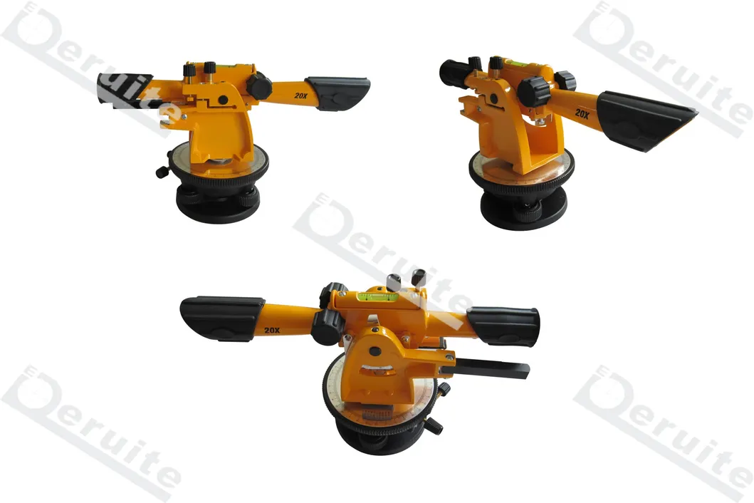
| Working range | 60m |
| Accuracy range | 3mm/30m |
| Image | erect |
| Magnification | 22x |
| Shortest focusing distance | 1.2m |
| Field of view | 1°20′ |
| Horizontal circle | yes |
| Graduation | 1° |
Related Category
Meter for Liquid & Gas
Weighing & Measuring Apparatus
Meter for Electricity
Pressure Gauge
Geographic Surveying Instrument
Electronic Scale
Measuring Device
Water Meter
Physical Measuring Meter
Thermometer & Hygrometer
Energy Meter & Power Meter
Multimeter
Send Inquiry
Please Feel free to give your inquiry in the form below. We will reply you in 24 hours.

")


")