

")
Optical Collimator for Optical Instrument (W550-10TD)
W550-10TD is for calibration and maintenance of the autolevel,theodolite,ttotal station and laser/optical plummet *Main Technical Parameters:<o:p> <o:p> Tube length: 565mm<o:p> Tube focus: 550mm<o:p> Tube Aperture: 57mm<o:p> Resolution: 3"<o:p> Angle o......
Send Inquiry
Product Description
W550-10TD is for calibration and maintenance of the autolevel,theodolite,ttotal station and laser/optical plummet
*Main Technical Parameters:<o:p>
<o:p>
Tube length: 565mm<o:p>
Tube focus: 550mm<o:p>
Tube Aperture: 57mm<o:p>
Resolution: 3"<o:p>
Angle of field of view: 10°20'<o:p>
Accuracy(Reticle's division value): 30"<o:p>
Tubes position: <o:p>
Horizontal(0°,45°,90°,270°,315°),vertical(90°),elevation(15°,30°)<o:p>
and depresion(15°,30°) <o:p>
Adjusting range of the tubes: Horizontal:≥60´, Vertical:≥60' <o:p>
<o:p>
Magnification: 5.7~7X<o:p>
The shortest target of the level tube: 2m<o:p>
The far target: ∞ <o:p>
Lifting range of the lifting platform: 300mm<o:p>
Max. Loading weight on support column: 40kgs<o:p>
Round level(On the foundation of the front column): 8"/2mm, <o:p>
Power supply for tube: 4.5~6V,2.1W<o:p>
Switch power: 1~10A<o:p>
Lighting source: cold light (with adjustable intensity), green<o:p>
<o:p>
Shipment package:5WOODEN CASES,270KGS,1.08CBM. 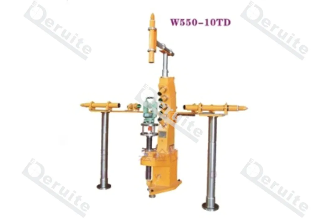

")


")