

Home > Products > Geographic Surveying Instrument > High Precision Chc I90 Gnss GPS Rtk for Construction Land Survey Equipment


High Precision Chc I90 Gnss GPS Rtk for Construction Land Survey Equipment
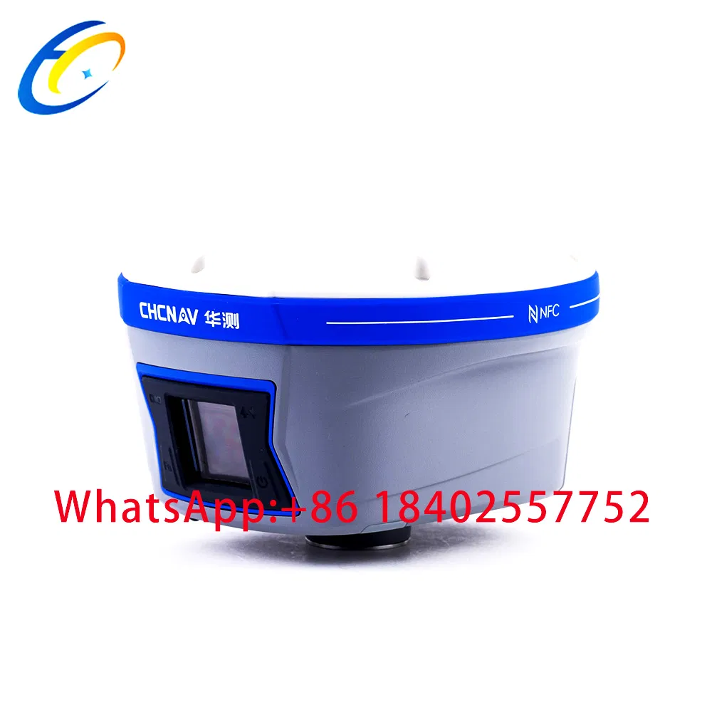
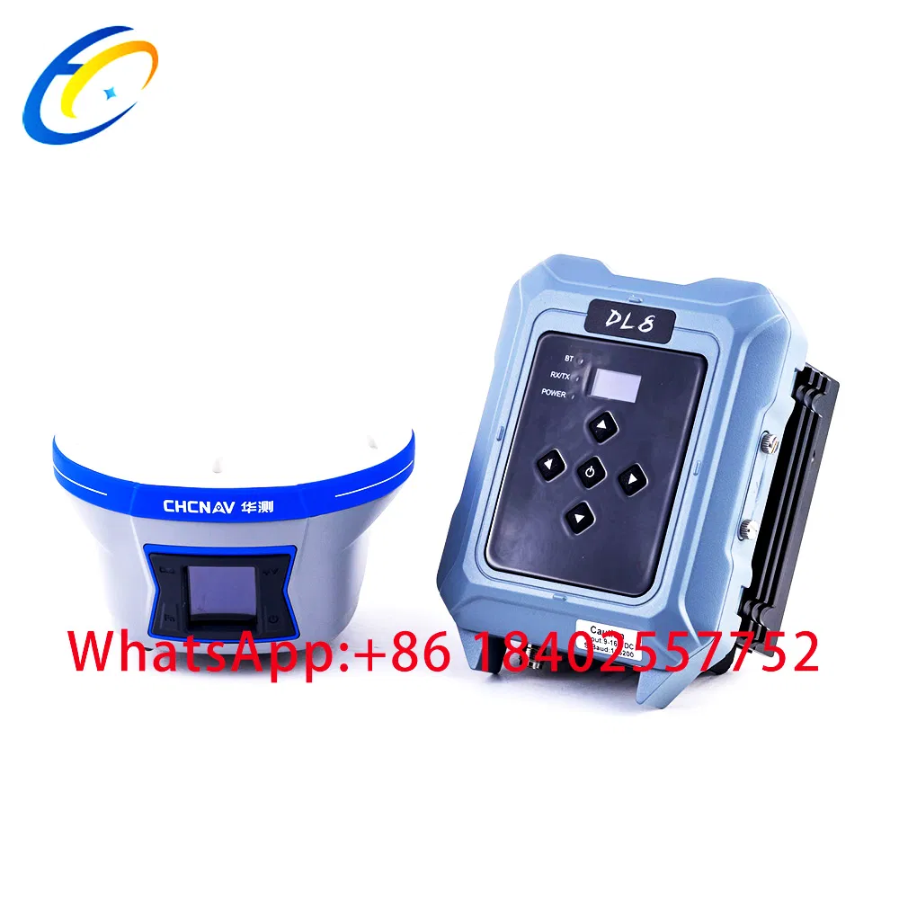
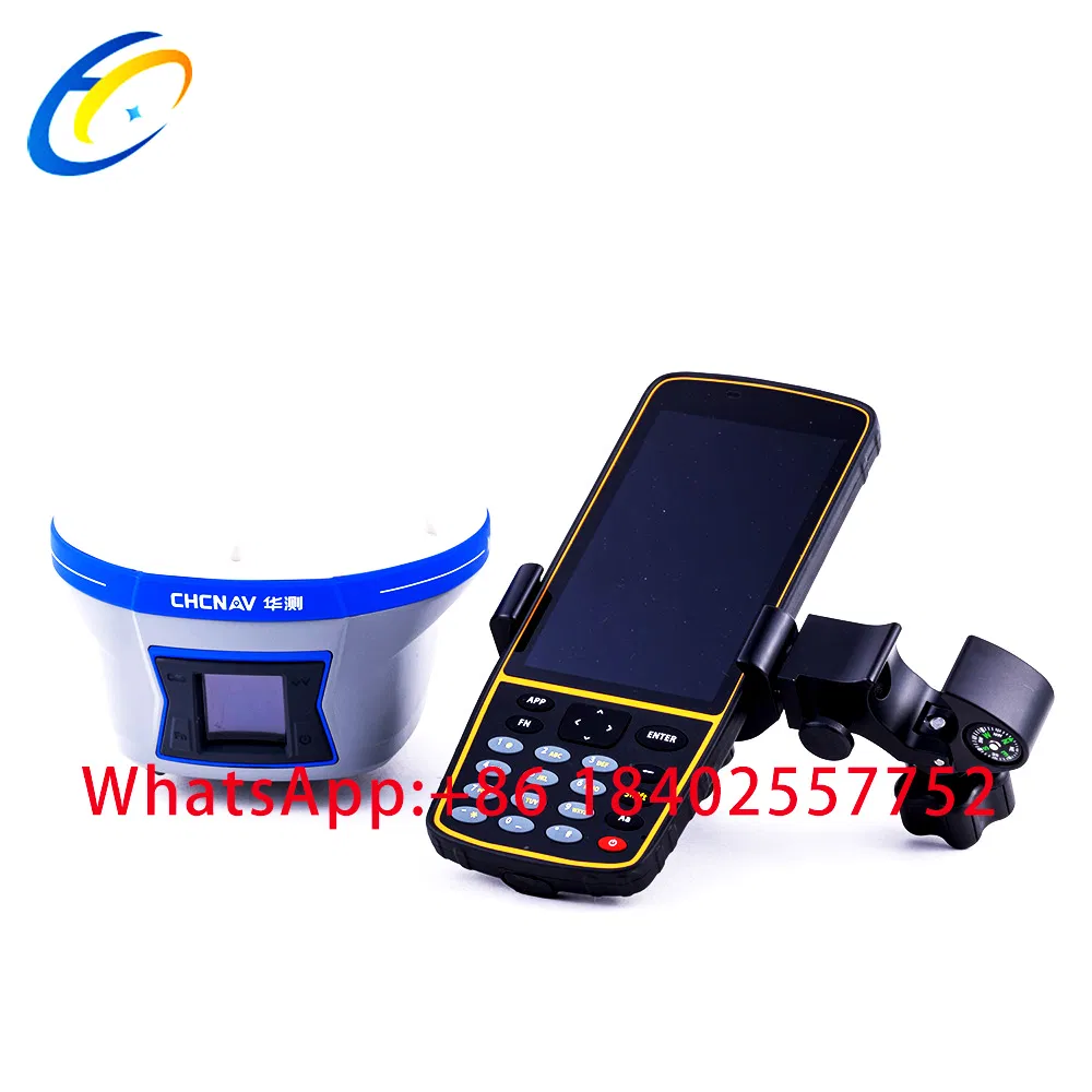
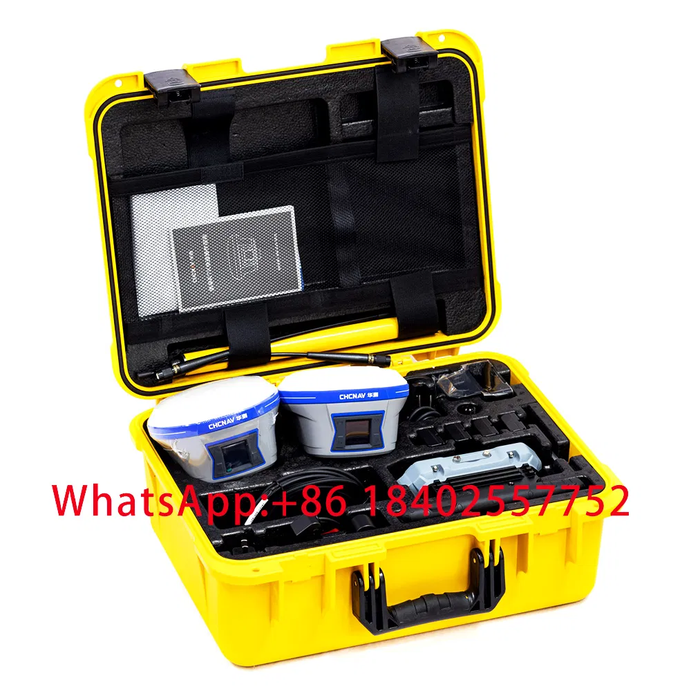
Key Features :1.BD990 trimble mainboad.2.Color screen.3.Revolutionary Tilt Survey With Built-in IMU4.360° Omni-directional Antenna and multi-protocol Radio5.Customer benefits from calibration free for tilt survey without centering. Once you reach the surveying points, immediately start the o......
Send Inquiry
Product Description
Key Features :
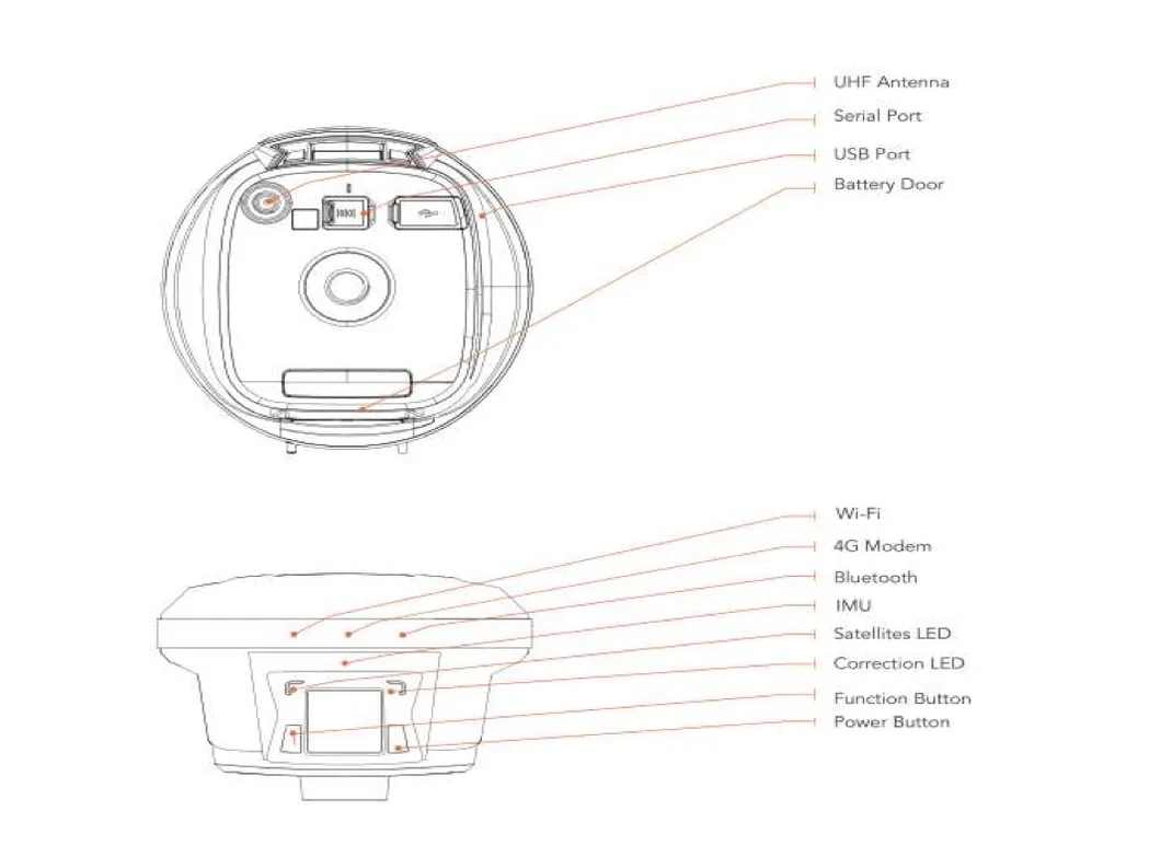
1.BD990 trimble mainboad.
2.Color screen.
3.Revolutionary Tilt Survey With Built-in IMU
4.360° Omni-directional Antenna and multi-protocol Radio
5.Customer benefits from calibration free for tilt survey without centering. Once you reach the surveying points, immediately start the operation. Compared with bubble leveling, boost working efficiency by 20%
High Precision CHC i90 GNSS GPS RTK for Construction land Survey Equipment
| i90 specification | |
| Channels | 336 channels with all in view simultaneously tracked satellite signals |
| GPS | L1C/A, L2C, L2E, L5 |
| GLONASS | L1C/A,L1P, L2C/A, L2P, L3 |
| Galileo | E1,E5A,E5B |
| BeiDou | B1,B2 |
| SBAS | L1C/A,L5 |
| (QZSS, WAAS, EGNOS, GAGAN) | |
| Global correction service: | RTP(optional) 5 Min |
| GNSS Accuracies (1) | |
| SBAS differential | 0.5 m RMS |
| positioning accuracy | |
| Highprecision static | |
| Horizontal | 2.5 mm + 0.1 ppm RMS |
| Vertical | 3.5 mm + 0.4 ppm RMS |
| Baseline Length | ≤ 300 km |
| PostProcessed Kinematic (PPK) | |
| Horizontal | 8 mm + 1 ppm RMS |
| Vertical | 15 mm + 1 ppm RMS |
| RTK | |
| Horizontal | 8 mm + 1 ppm RMS |
| Vertical | 15 mm + 1 ppm RMS |
| Initialization time | < 5 s |
| Initialization reliability | > 99.9% |
| Network RTK | |
| Horizontal | 8 mm + 0.5 ppm RMS |
| Vertical | 15 mm + 0.5 ppm RMS |
| Initialization time | < 10 s |
| Initialization reliability | > 99.9% |
| GNSS+Inertial navigation | |
| Tilt Angle | 0-60 |
| Tilt precision | 10mm+0.7mm/ tilt(30' precision<2.5cm) |
| Hardware | |
| Dimensions (H×W) | 190mm*98.5mm |
| Weight | 1.25 kg ( |
| Environment | |
| Operating | '-45 °C to +75 °C (40°F to 167°F) |
| Storage | '-55 °C to +85°C (67°F to 185°F) |
| Humidity | 100% condensation |
| Dust and Waterproof | IP68, protected from temporary |
| immersion to depth of 1 m (unit floats) | |
| Shock and vibration | 3m (6.56 ft) pole drop onto concrete, |
| MILSTD810G | |
| LCD | 128x128dpi sunlight readable with function/accept 1.46 OLED |
| buttons | |
| Certifications and Calibrations | |
| FCC Part 15 (class B Device), FCC Part 22, 24, 90; CE | |
| Mark; CTick; Bluetooth EPL, IGS & NGS Antenna | |
| Calibration, MILSTD810G. | |
| Communications and Data Recording | |
| Serial | 2 x 7pin LEMO port (external power, USB data |
| download, USB update, RS232) | |
| Bluetooth® | BT 4.0 |
| compatible with Android, Windows Mobile and Windows | |
| WiFi | 802.11 b/g/n, access point mode |
| NFC | NFC flash even |
| UHF Radios (2) | Frequency: 450-470MHz |
| Channels:120 adjustable | |
| Transmitting power:2W | |
| agreement:CHC/TT450/Southradio/Transparent | |
| Working Range:3-5km typical, 8-10km optimal | |
| External UHF Radio(Standard) | Frequency: 450-470MHz |
| Channels:120 adjustable | |
| power:30W adjustable | |
| agreement:CHC/TT450/Southradio/Transparent | |
| Working Range:8~10km typical,15~20km optimal | |
| Electrical | |
| Power consumption | <3.2 W |
| Liion battery capacity | 2 × 3400 mAh, 7.4 V |
| Operating time | RTK UHF Base: 8 h |
| RTK Rover: 10 h | |
| Static: 10 h | |
| External power | 9 to 28V DC |
Related Category
Meter for Liquid & Gas
Weighing & Measuring Apparatus
Meter for Electricity
Pressure Gauge
Geographic Surveying Instrument
Electronic Scale
Measuring Device
Water Meter
Physical Measuring Meter
Thermometer & Hygrometer
Energy Meter & Power Meter
Multimeter
Send Inquiry
Please Feel free to give your inquiry in the form below. We will reply you in 24 hours.

")


")