


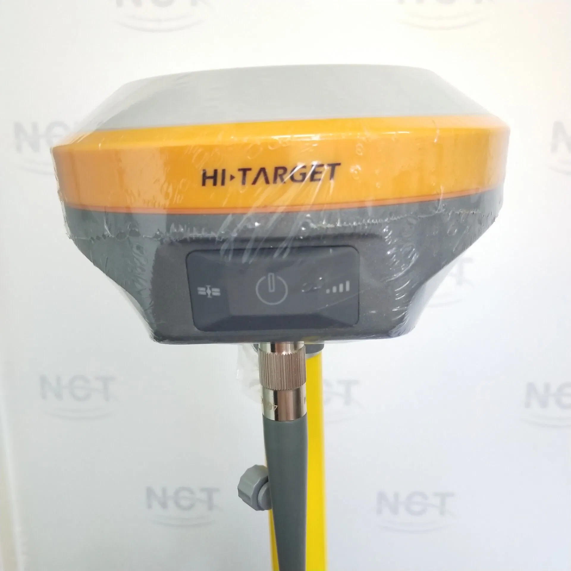

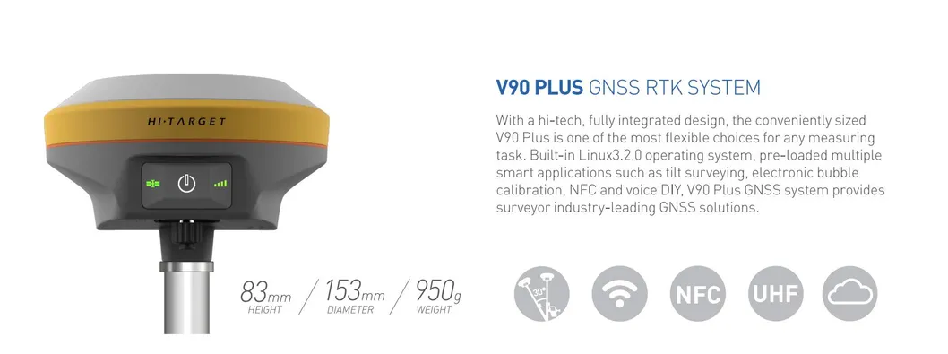
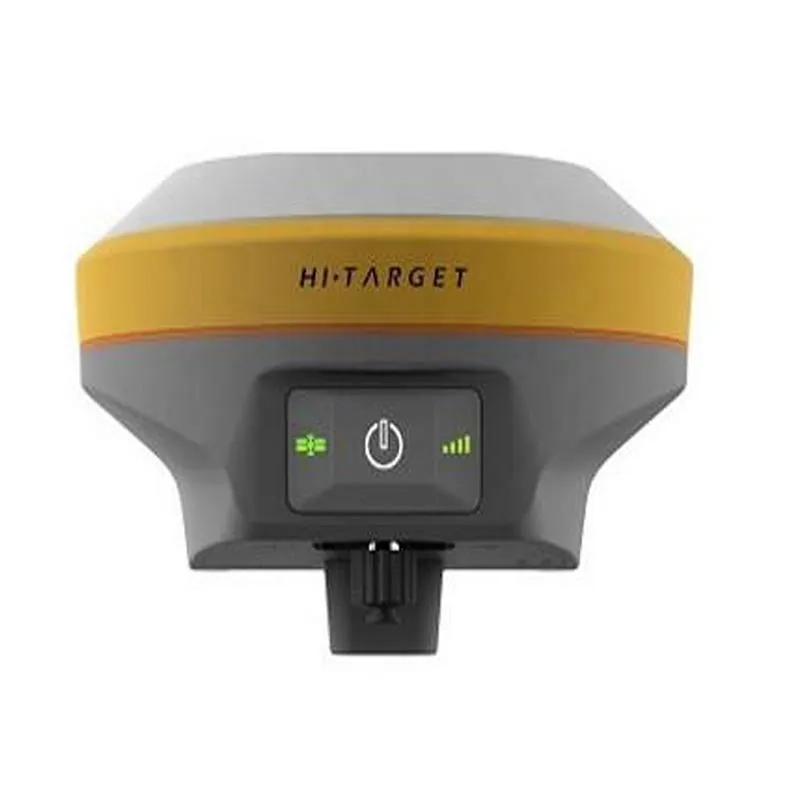
High Accuracy Positioning Measuring GPS Bds Glonass V90 Plus Gnss
SPECIFICATIONSStatellite Signals Tracked SimultaneouslyChannel220 ChannelsGPSSimultaneous L1C/A, L2C, L2E, L5GLONASSSimultaneous L1C/A, L1P, L2C/A,(GLONASS M only), L2PSBASSimultaneous L1C/A, L5GalileoSimultaneous L1 BOC, E5A, E5B, E5AltBOC1BDSB1, B2QZSSL1C/A, L1 SAIF, L2C, L5POSITIONING PERFORMANC......
Send Inquiry
Product Description


SPECIFICATIONS
Statellite Signals Tracked Simultaneously | |
Channel | 220 Channels |
GPS | Simultaneous L1C/A, L2C, L2E, L5 |
GLONASS | Simultaneous L1C/A, L1P, L2C/A, |
SBAS | Simultaneous L1C/A, L5 |
Galileo | Simultaneous L1 BOC, E5A, E5B, E5AltBOC1 |
BDS | B1, B2 |
QZSS | L1C/A, L1 SAIF, L2C, L5 |
POSITIONING PERFORMANCE2 | |
Horizontal | 2.5mm+0.5ppm RMS |
Vertical | 5mm+0.5ppm RMS |
Post Processing Kinematic (PPK / Stop & Go ) GNSS Surveying | |
Horizontal | 1mm+1ppm RMS |
Vertical | 2.5mm+1ppm RMS |
Initialization time | Typically 10 minutes for base while 5 minutes for rover |
Initialization reliability | typically > 99.9% |
Code Differential GNSS Positionnig | |
Horizontal | 25cm+1ppm RMS |
Vertical | 50cm+1ppm RMS |
SBAS | 0.50m Horizontal, 0.85m Vertical |
COMMUNICATION | |
Network Communication | |
Fully integrated, fully sealed internal WCDMA, compatible with GPRS, GSM | |
Wifi frequency is 2.4G, supports 802.11b/g/n protocol | |
Network RTK (via CORS) range20-50km | |
HI-TARGET Internal UHF Radio(Standard) | |
Frequency | 450~470MHz with 116 channels |
Transmitting power | 1W, 2W, 5W adjustable |
Transmitting speed | 9.6Kbps, 19.2Kbps |
Working range | 5km typical, 8~10kmoptimal |
HI-TARGET External UHF Radio(Standard) | |
Frequency | 460MHZ with 116 channels |
Transmitting power | 5W,10W,20W,30W adjustable |
Transmitting speed | Up to 19.2Kbps |
Working range | 8~10km typical,15~20km optimal |
HARDWARE | |
Physical | |
Dimensions(W×H) | 153mm×83mm(6.02inch×3.27inch) |
Weight | 950g(2.09(b)without internal battery |
Operating temperature | -40ºC to+65ºC(-40ºF to+149ºF) |
Storage temperature | -55ºC to+85ºC(-67ºF to+185ºF) |
Humidity | 100%,considering |
Water/dustproof | IP67 dustproof,protected from temporary immersion to depth of 1m(3.28ft) |
Shock and vibration | Designed to survive a 3m(9.84ft) natural fall onto concrete |
Electrical | |
Power 6V to 28V DC external power input | |
Power consumption≤3.5W | |
Automatic switching between internal power and external power | |
Rechargeable,removable 7.4V,5000mAh Lithium-ion battery in internal battery compartment | |
Internal Battery Life | |
Static more than 10 hours | |
RTK rover (UHF/GPRS/3G)6-10 hours | |
RTK base more than 6 hours | |
I/O Interface | |
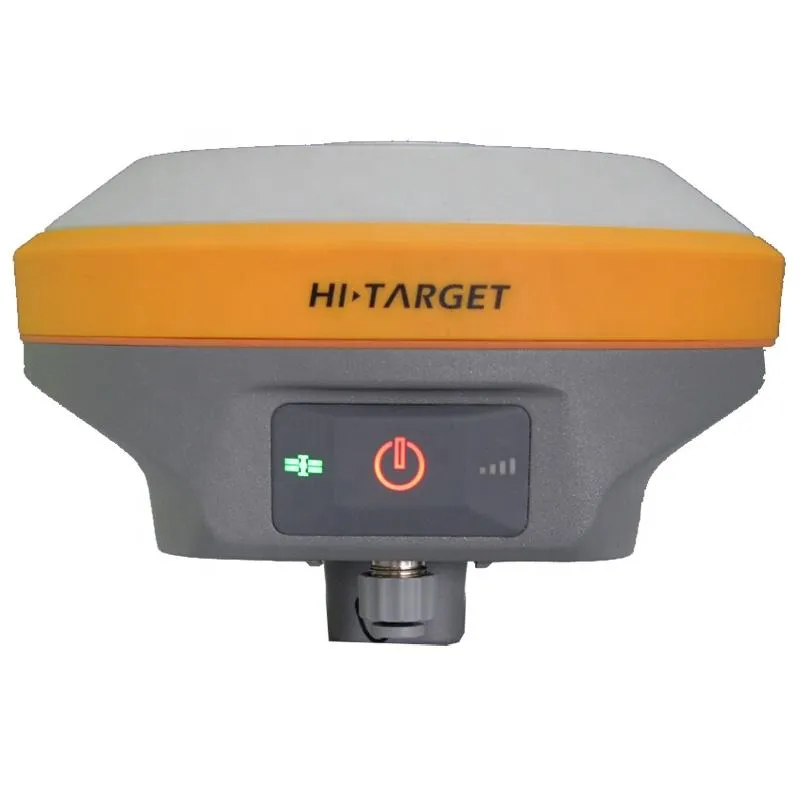
Bluetooth, NFC | ×1 |
standard USB2.0port | ×1 |
TNC antenna connector | ×1 |
RS232 serial port | ×1 |
DC power input (5-pin) | ×1 |
MicroSD card port | ×1 |
Data storage | 16GB internal storage+Internal Micro SD Card memory |
Record GNS and Rinex format simultaneously | |
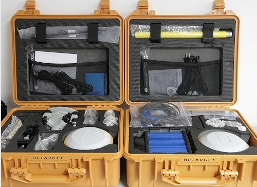
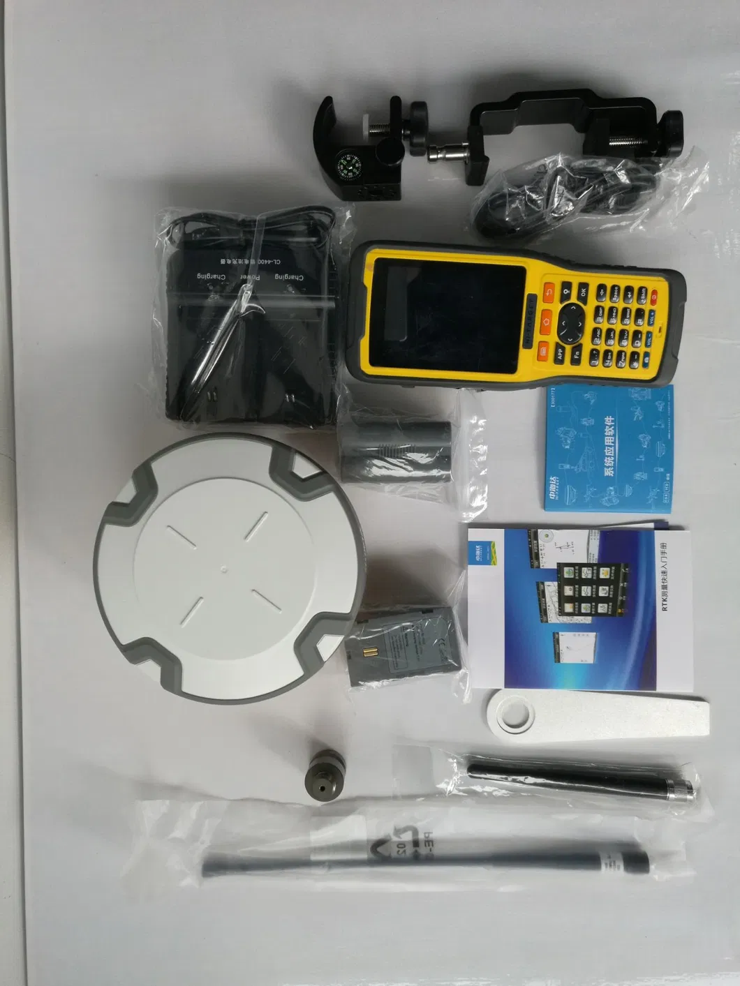
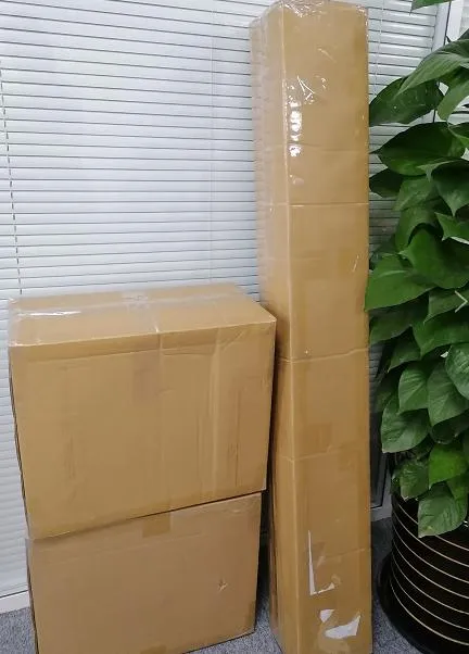
Packing & Delivery

Company Profile

was established in Shanghai China. We are engaged in providing high-precision surveying and mapping instrument. The involved industries include land survey, construction, marine and UAV
Till now, we have a professional sales team with 5 year experience in average. Branch office in the USA, DUBAI, India and South Africa offers local technical support to word wide users. We put technical support and ll be input our Rafter sale service as our highest level principle. 10% of our revenue is input into R&D every year. We never stop developing a better product for our customer. Quality issues are at the forefront of NEWDI's philosophy. NEWDI received ISO 9001 certification from International Standards Organization. It applies to all aspects of NEWDI's every development process and workflow, covering all steps from the initial design to the final delivery.
Our distribution network covers more 10 countries. We take the mission to make survey easier. We are proud of the value that customer benefit from our service and returns continuous trust to NEWDI.
FAQ
1. who are we?
We are based in Shanghai, China, start from 2016,sell to Southeast Asia(30.00%),Africa(25.00%),South America(15.00%),North America(10.00%),Mid East(5.00%),South Asia(5.00%),Eastern Europe(3.00%),Oceania(2.00%),Central America(2.00%),Southern Europe(2.00%),Eastern Asia(1.00%). There are total about 1-4 people in our office.
2. how can we guarantee quality?
Always a pre-production sample before mass production;
Always final Inspection before shipment;
3.what can you buy from us?
GNSS Receiver,Total Station,Level,UAV,Marine Product
4.why should you buy from us not from other suppliers?
Offer technical support and repair by our experts; Give survey consultance to fresh surveyors; Present suggestion on suitable equipment and software according to csutomer's project request
5. who are we what services can we provide?
Accepted Delivery Terms: FOB,CFR,CIF,EXW,FAS,CIP,FCA,CPT,DEQ,DDP,DDU,Express Delivery,DAF,DES;
Accepted Payment Currency:USD,EUR,JPY,CAD,AUD,HKD,GBP,CNY,CHF;
Accepted Payment Type: T/T,L/C,PayPal,Western Union,Cash;
Language Spoken:English,Chinese,Spanish,Hindi

")


")